NLD
Quetzalcóatl International Airport
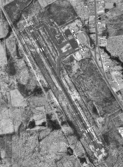

Quetzalcóatl International Airport (IATA: NLD, ICAO: MMNL) is a medium airport in Nuevo Laredo, Tamaulipas, Mexico. It has one runway, 2,000 m (6,562 ft) long, asphalt. It is operated by Aeropuertos y Servicios Auxiliares. In 2025 it handled 167 thousand passengers.
Runways & airfield
Schematic · N · © OpenStreetMap14/32151° / 331° · LIT
LENGTH2,000 m6,562 ftWIDTH45 m148 ftSURFACEAsphalt
Passengers per year
2014–202567K
73K
84K
78K
64K
65K
29K
54K
107K
198K
152K
167K
141516171819202122232425
Routes
4 destinations · 1 countryYear-round4
TAMGeneral Francisco Javier Mina International AirportMexico · Viva598 km372 miNLUFelipe Ángeles International AirportMexico · Viva858 km533 miMEXMexico City Benito Juárez International AirportMexico · Aeroméxico Connect892 km554 miCUNCancún International AirportMexico · Viva1,470 km913 miMost destinationsViva 3Aeroméxico Connect 1
Straight lines are great circles; rings mark true distance from NLD. From the Wikipedia article “Nuevo Laredo International Airport” (revision of 4 Sep 2026), CC BY-SA 4.0.
Records & rankings
Ranked among 48,011 open airports · world · region · countryScale: share of airports ranked below, best on the right · ties shown as = and a band · passengers are each airport’s latest year on record
Radio frequencies
1 channelsAPPNUEVO LAREDO APP/TWR118.300