SMO
Santa Monica Municipal Airport
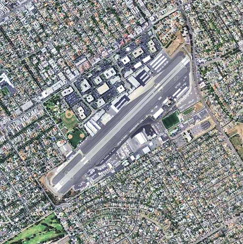

Santa Monica Municipal Airport (IATA: SMO, ICAO: KSMO) is a medium airport in Santa Monica, California, United States. It opened in Apr 1940. It closed on 31 Dec 2028. It has one runway, 3,500 ft (1,067 m) long, asphalt. It is operated by Santa Monica.
Timeline
2 events · 1940–2028APR 1940
OpenedSanta Monica Municipal Airport opens.
31 DEC 2028
ClosedSanta Monica Municipal Airport closes.
From WikidataEvery airfield, 1903–2026
Runways & airfield
Schematic · N · © OpenStreetMap · 1 helipad · FAA diagram PDF03/21044° / 224° · LIT · SLOPE 1.2%
LENGTH3,500 ft1,067 mWIDTH150 ft46 mSURFACEAsphalt
Routes
4 destinations · 1 countryStraight lines are great circles; rings mark true distance from SMO. Dashed: seasonal or charter. From the Wikipedia article “Santa Monica Airport” (revision of 14 Sep 2026), CC BY-SA 4.0.
Records & rankings
Ranked among 48,011 open airports · world · region · countryScale: share of airports ranked below, best on the right · ties shown as = and a band · passengers are each airport’s latest year on record
Radio frequencies
7 channelsAPPSOCAL APP124.300
ATISATIS119.150
CTAFCTAF120.100
DEPSOCAL DEP125.200
GNDGND121.900
TWRTWR120.100
UNICUNICOM122.950