COU
Columbia Regional Airport

Columbia Regional Airport (IATA: COU, ICAO: KCOU) is a medium airport in Columbia, Missouri, United States. It has 2 runways; the longest is 7,401 ft (2,256 m). In 2025 it handled 245 thousand passengers.
Runways & airfield
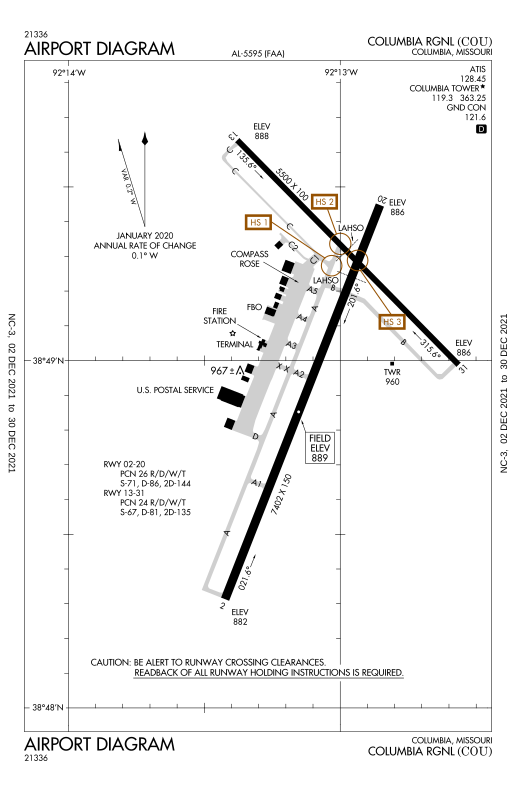
Schematic · N · © OpenStreetMap · FAA diagram PDF02/20021° / 201° · LIT
LENGTH7,401 ft2,256 mWIDTH150 ft46 mSURFACEConcrete
13/31135° / 315° · LIT
LENGTH5,500 ft1,676 mWIDTH100 ft31 mSURFACEConcrete
Passengers per year
2015–2025132K
130K
177K
242K
260K
103K
160K
166K
196K
207K
245K
1516171819202122232425
Routes
4 destinations · 1 countryYear-round4
ORDChicago O'Hare International AirportUnited States · United Express, American Eagle507 km315 miDFWDallas Fort Worth International AirportUnited States · American Eagle788 km490 miDENDenver International AirportUnited States · United Express1,076 km669 miCLTCharlotte Douglas International AirportUnited States · American Eagle1,077 km669 miMost destinationsAmerican Eagle 3United Express 2
Straight lines are great circles; rings mark true distance from COU. From the Wikipedia article “Columbia Regional Airport” (revision of 16 Jul 2026), CC BY-SA 4.0.
Records & rankings
Ranked among 48,011 open airports · world · region · countryScale: share of airports ranked below, best on the right · ties shown as = and a band · passengers are each airport’s latest year on record
Radio frequencies
7 channelsA/DMIZZU APP/DEP124.375
ATISATIS128.450
CTAFCTAF119.300
GNDGND121.600
RDORDO122.200
TWRTWR119.300
UNICUNICOM122.950