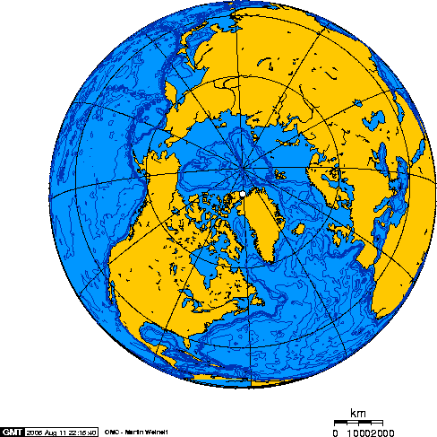

The further north an airport lies, the smaller the list of places that can be reached from it. Above 76° N, it comes down to one airport in Svalbard, two airfields in north-west Greenland and one in the Canadian Arctic. Beyond them lie a few runways with regular flights that the public cannot book, and military stations supplied from the air.
Longyearbyen
LYRSvalbard Airport, Longyear NO · 27 M / 88 FT · RWY 2,319 M / 7,608 FT78.25° N. Scheduled flights to Oslo and Tromsø. Opened 2 September 1975.ENTRYSvalbard Airport, outside Longyearbyen, is the northernmost airport with scheduled public flights. It was built between 1973 and 1975 and opened by King Olav V on 2 September 1975.1 SAS and Norwegian fly there from Oslo and Tromsø.2 From mid-November to the end of January the sun does not rise.2
Svalbard is part of Norway but not part of the Schengen area, so the passport check happens on the mainland, at Oslo or Tromsø.3
The runway, about 2.3 km of asphalt, was laid on ice-rich permafrost without a proper geotechnical survey. Engineers later found ice lenses up to 50 mm thick beneath it and about a third of its length affected by thaw settlement. Patching the hollows had raised the original 60 mm of asphalt to 350 mm. In 1989 the worst sections were rebuilt with a layer of polystyrene insulation in the gravel embankment.4 A study in 2005 found no immediate threat, but warned that a warming climate would make the runway steadily more expensive to maintain.5 In 2025 the airport's manager told CNN that in summer the runway had to be checked "meticulously every day because the soil might subside at any point".6
Further north, but not for sale
ENASNy-Ålesund Airport, Hamnerabben NO · 15 M / 50 FT · RWY 808 M / 2,651 FT78.93° N. Flights for the research town only; no tourist access.ENTRYNy-Ålesund, a research town on the west coast of Spitsbergen, has its own gravel runway. A Dornier 228 flies there from Longyearbyen twice a week in winter and four times a week in summer. The seats are booked by Kings Bay, the company that runs the town, and "there is no access for tourists".7 Svea, a mining settlement, had some thirty flights a week for its miners until mining ended; its airstrip was shut in 2022 and removed.8
Greenland
NAQQaanaaq Airport GL · 16 M / 51 FT · RWY 900 M / 2,953 FT77.49° N. Gravel runway, opened 2001. One flight a week via Upernavik.ENTRYQaanaaq, in the far north-west of Greenland, got its gravel runway in 2001, about 7 km west of the town. Before that, travellers flew into the American base at Thule and continued by helicopter.9 Air Greenland now flies there once a week, by way of Ilulissat and Upernavik.10
North of Qaanaaq, Siorapaluk has a heliport at 77.79° N. It is the northernmost point in Greenland with civilian flights: helicopters to Qaanaaq under a contract with the Government of Greenland. They carry mostly cargo and are not in the printed timetable, but seats can be booked in advance.11 The base at Thule, renamed Pituffik Space Base in 2023, has a 3 km runway and Air Greenland flights. Without a permit from the Danish foreign ministry, passengers are turned away.12
Canada
YGZGrise Fiord Airport CA · 45 M / 146 FT76.43° N. About 510 m of gravel. Twin Otter flights from Resolute, twice a week.ENTRYGrise Fiord, on Ellesmere Island, is the northernmost community in Canada, with about 140 people. Twice a week a Twin Otter comes in from Resolute on a gravel strip about 510 m long. The flights are sold by Canadian North and flown by Kenn Borek Air, and a one-way ticket costs more than C$1,000.1314 The community itself goes back to 1953. That year the federal government moved Inuit families from Inukjuak, in northern Quebec, and from Pond Inlet to Grise Fiord and Resolute. In 2010 it formally apologised for the relocation.15
Resolute, at 74.72° N, began as a joint Canadian-American weather station and airstrip in 1947. Its runway is almost 2 km long and, like Grise Fiord's, gravel.16
North of Grise Fiord the flights stop being public. Eureka, a weather station at almost 80° N, is supplied by air about every six weeks.17 Alert, at 82.5° N and 817 km from the Pole, is the most northerly permanently inhabited place in the world. It is a military station, reached by Royal Canadian Air Force transports.18
YLTAlert Airport CA · 31 M / 100 FT · RWY 1,676 M / 5,500 FT82.52° N. Military station; no public flights.ENTRYWhy gravel
Most of these runways are gravel for the same reason Longyearbyen's needed insulation. Dark asphalt absorbs heat and passes it to the frozen ground below, and ice-rich soil that thaws settles and loses its strength.19 A gravel surface can simply be regraded when the ground shifts. In Canada's three territories, a 2020 survey counted 75 gravel runways against 11 paved ones.20 The price is paid by the aircraft: most modern airliners are not certified to use gravel without special kits.20
Sources
-
Avinor, "Flyplassen som endret alt: Svalbard lufthavn markerer 50 år", 2025 (in Norwegian).
-
Visit Svalbard, visitor FAQ: flights with SAS or Norwegian; polar night 14 November – 29 January. Avinor, Svalbard Airport. 2
-
Governor of Svalbard, visas and immigration; Norway, visiting Svalbard.
-
G. Mølmann, Y. Bergheim, M. Valeriote, "Svalbard Airport Geotechnical Study", 7th International Conference on Permafrost, Yellowknife, 1998. Sources give the runway as 2,319 m (AIP-derived data, as in the register) or up to 2,484 m.
-
A. Instanes, O. Mjureke, "Svalbard airport runway: performance during a climate-warming scenario", Bearing Capacity of Roads, Railways and Airfields, 2005.
-
CNN, "The world's northernmost airport is melting", April 2025; also reported by Interesting Engineering.
-
Kings Bay AS, flight, harbour and fuel. The register gives the runway as 808 × 30 m, gravel, corrected from OurAirports' 927 m of asphalt (data page).
-
Svea Airport, English Wikipedia: closed 1 August 2022.
-
Trap Grønland, Qaanaaq. The register gives the runway as 900 × 30 m, corrected from OurAirports' 1,010 × 100 m (data page).
-
Air Greenland, flights to Qaanaaq.
-
Siorapaluk Heliport, English Wikipedia. Frequency and aircraft type could not be confirmed from Air Greenland.
-
Air Greenland, Pituffik; Ministry of Foreign Affairs of Denmark, Pituffik Space Base.
-
Nunatsiaq News, "Cost of living top of mind in Grise Fiord ahead of federal election", 24 April 2025.
-
Canada Flight Supplement data via SkyVector, CYGZ: runway 14/32, 1,675 × 75 ft, gravel. Government of Nunavut, Grise Fiord airport.
-
Crown-Indigenous Relations and Northern Affairs Canada, apology for the High Arctic relocation, 18 August 2010.
-
The Canadian Encyclopedia, Resolute; Canada Flight Supplement data via SkyVector, CYRB: runway 17/35, 6,504 ft, gravel.
-
Eureka, Nunavut, English Wikipedia; Legion Magazine, "Weather station Eureka".
-
Royal Canadian Air Force, Canadian Forces Station Alert.
-
Alaska Department of Transportation and Public Facilities, building on permafrost.
-
North American and Arctic Defence and Security Network, Canadian Arctic airports, November 2020. 2
Codes, elevations and runway lengths in the airport cards are from the Dromopedia register, built from OurAirports. Each entry’s data page names the source of every field; see also About the data.